Groundwater from complex aquifers feeds irrigated crops worth billions, and it’s drying up. Washington State University researchers contribute to understanding and solving those water needs.
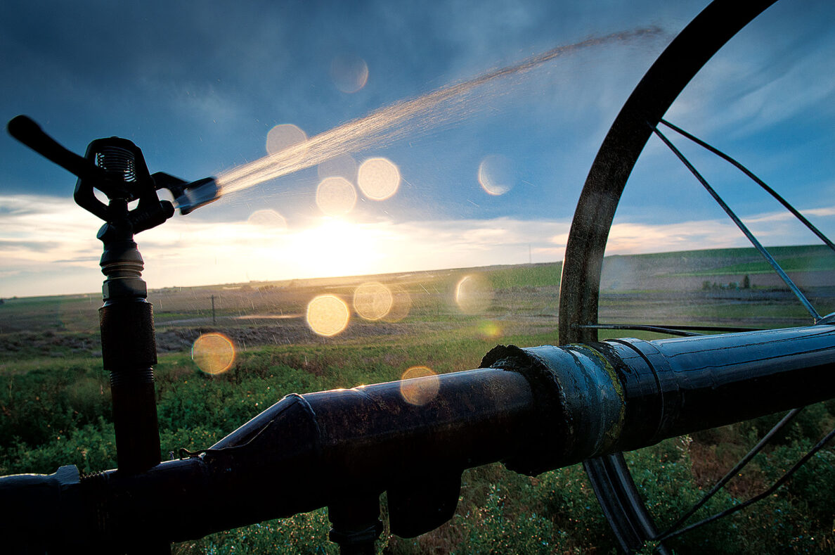
On a bleached-blue July morning, with the temperature approaching 100, Sasha McLarty pilots a van through the arid fields of eastern Washington.
She and her crew of graduate students are shuttling between stops on a tour of a new irrigation system. They drive to the banks of a fresh stretch of canal. They tour a pumphouse. They listen as farmers sing the praises of the new system.
“Woo-hoo!” McLarty exclaims after one stop. “It’s so exciting!”
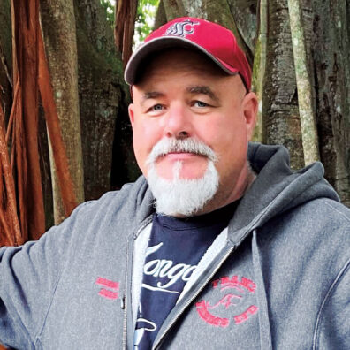
 Courtesy Sasha McLarty/LinkedIn
These canals represent the fulfillment of a century-old plan to dam and divert water for irrigation from the Columbia River. The water has come a long way, and taken a long time to arrive, to say nothing of millions upon millions of dollars and years of effort from scores of public agencies.
“I don’t know of any project globally,” McLarty tells the tour group, “that is as cool as this one.”
McLarty’s excitement has a lot to do with water that no one on the tour can see: the groundwater that flows and pools deep underground, in the Columbia Plateau Regional Aquifer System. That water is vital to the Northwest, but it’s being used up at an unsustainable pace. Bringing surface water from the dam project is “a rescue mission to save the aquifer,” in the words of Jon Erickson, development coordinator for the East Columbia Basin Irrigation District.
Monitoring, protecting, and understanding the aquifer system has been McLarty’s mission as a researcher and associate professor in Washington State University’s Department of Civil and Environmental Engineering. Using data from wells across the region, she has produced new measures of aquifer sustainability and identified “hot spots” where the urgency is greatest.
The Othello Subarea Aquifer is the hottest of the hot. Farmers in this part of eastern Washington grow more than 100 crops, with an annual value in the billions, but they have been water-hungry for decades, drawing heavily on groundwater wells until they go dry.
Enter the coolest project in the world. The Odessa Groundwater Replacement Project, or OGWRP, offers farmers the chance to voluntarily switch from groundwater to surface water from the dam system. Thousands of acres have been moved off deep-water wells in recent years, with future expansion to come.
If the project is a rescue mission for the aquifer, it’s also crucial for keeping the crops green and farmers in business.
“I get calls in my office every day: ‘We’ve just lost another well, we’ve just lost another well,’” Erickson says. “I’ve had grown men come into my office and cry. Literally cry. ‘I need this water or I’m going to lose my farm.’”
A complicated layer cake
When you think of an aquifer, you might imagine an underground lake in a dark cavern. In reality, an aquifer system is more like an interconnected series of pockets and layers, with distinct geological tiers of different thicknesses at different depths.
The Columbia Plateau aquifers are literally woven into the land, flowing and pooling among layers of basalt and sediment beneath the surface. These layers reflect the region’s tumultuous geographic history, a tale of fire and flood and tectonic eruptions. They also give shape to an aquifer system of thorny complexity.
The layers overlap in some places, and not in others. The system includes both confined aquifers—those buried and disconnected from the land surface—and unconfined aquifers, where water seeps and flows more freely. Water moves around thick layers of basalt that were formed during periods of volcanic activity, then folded and cracked in unusual ways.
“This is a really interesting aquifer, and by interesting I mean really hard and complex,” McLarty says. “It’s really a double whammy of complexity.”
Her research seeks to untangle that complexity, to identify the sustainability of groundwater in specific locations, and to implement a new method of measuring the accessibility of groundwater—based not on the amount of water available, but how much is available given current well depths.
“What I care about most is, will people and ecosystems have groundwater in the future to the extent that they need it?” she says. “I hope these data can be used to help prioritize investments in improving water security, by showing where that effort is needed.”
The Columbia system underlies parts of Washington, Idaho, and Oregon, an area that is primarily semi-arid with average annual precipitation between 7 and 15 inches a year. Much of that is cropland, supporting a multibillion-dollar agricultural industry that produces wheat, corn, potatoes, apples, grapes, and other crops. Groundwater is the primary source of municipal and drinking water supplies and supports much of the irrigation for that land.
The system is made up of four primary units: the youngest layer, the Overburden unit, is comprised of unconsolidated to semi-consolidated sedimentary deposits dating back millions of years. Three other units arrayed below the Overburden layer—the Saddle Mountains, Wanapum, and Grande Ronde formations—are basalt layers formed during the volcanic past of the region millions of years ago. Each layer ranges from several hundred to nearly 4,000 feet thick or more.
McLarty describes the aquifer as akin to a layer cake: the basalt and sedimentary layers are the cake, and the water is the frosting. However, the aquifer’s layers are nowhere near as uniform as a cake. At any given point on the map, people are drawing from different layers and depths.
McLarty’s research builds on past studies showing that the Columbia aquifer system is declining in most spots. There are bright spots such as the Spokane area, where conservation efforts have helped preserve groundwater levels.
The overall picture, though, is one of decline and a need to preserve the water for the future. That’s especially true in the Odessa area, where water levels are dropping by more than 10 feet per year in some parts.
A long wait
Before concrete was laid for the Grand Coulee Dam on the Columbia River, farmers signed up to draw upon the water from the dam to grow their crops.
For many of them, it’s been a long wait.
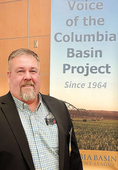
Dennis Swinger Jr.’s great-great-grandfather applied for water rights from the dam in the 1920s—just a few years after arriving from South Dakota and establishing the Lind-area farm that’s still producing crops. During the dam’s construction in the 1930s, he would take visitors out to watch the work proceed.
Swinger’s great-aunt told him: “Daddy was so proud of this you’d have thought it was his own project.”
(Courtesy Columbia Basin Development League)
The dam was completed in 1942. One goal of the subsequent Columbia Basin Project was to provide irrigation for 1.1 million acres of farmland. Less than two-thirds of that irrigation materialized, though, as wars and other priorities continually pushed back funding of the rest. While farmers in the Odessa area waited, the state granted them groundwater rights.
They sunk wells to keep the crops growing.
Then, as the years went on, they sunk them deeper.
“There’s nothing more permanent than a temporary fix,” says Swinger (’90 Ag.), one of several Cougs in his family.
The temporary fix has been less than ideal for farmers. Even when they could drill deeper, they encountered water that is so high in sodium and other minerals that it alters soil chemistry. And the uncertainty of just how long that water would last has hung over farmers year over year.
The OGWRP water changes things entirely. The new surface water supply is ample and reliable The water quality is good. And farmers can grow more high-value crops—such as potatoes—that were more difficult when they were inching by on groundwater.
“There’s zero constraint, comparatively, on the amount of water available to them,” says Craig Simpson (’90 Civ. Eng.), secretary-manager of the East Columbia Basin Irrigation District. “On top of that, there’s the water quality. When they’re pumping water from a well that goes 2,000 feet down, the water’s nasty.”
(Courtesy Columbia Basin Development League)
For two decades, Simpson and many others have been working to bring irrigation to farmers from the dam project. Built on funding and collaboration among state and federal agencies, agricultural organizations, and irrigation companies, OGWRP first began extending irrigation canals, pumphouses, and other infrastructure into the farmlands around Othello with a small pilot project in 2005. It’s been adding acreage in phases ever since.
The goal is to move 87,000 acres from groundwater to surface water irrigation, and take the wells drawing on the aquifer offline. So far, the project is delivering water to about 16,000 acres, with another 19,000 under contract for future delivery. A phase now under construction will bring water to another 13,000 acres.
The project has cost tens of millions of dollars, with primary funding coming from the state of Washington, the federal Bureau of Reclamation, the East Columbia Irrigation District, and landowners. Scores of stakeholders have moved the project forward, including agricultural and conservation organizations, as well as WSU.
Switching to the canal project comes with costs for farmers. Depending on the point in the system where their land is, they need to build the connection system to bring it to their fields. For some, it’s a major investment. Paul Wollman of the Warden Hutterite Colony likened it to “buying my farm all over again.” But it significantly benefits Wollman, who has been doing everything he can to conserve water, including till methods that help reduce erosion and improve moisture retention.
“We’re making use of every drop of water out here,” Wollman says. “In the last four years, we had four wells go dry on us.”
Swinger joined the OGWRP in 2020, taking two of his five wells offline. Those wells started out at depths of 350.
“As the aquifer has declined, now we’re at 1,200 feet,” he says.
Swinger, a sixth-generation farmer, is grateful for what the water means to his family’s land and agricultural prospects. But he sees the OGWRP as a crucial tool for society at large—keeping crucial agricultural land in production at a time when the demand for food is rising, the climate is changing, and the amount of farmland isn’t growing.
“This is a food security issue,” Swinger says. “Washington grows some 300 different crops.
“We can grow just about anything. Let’s build this project before people start going hungry.”
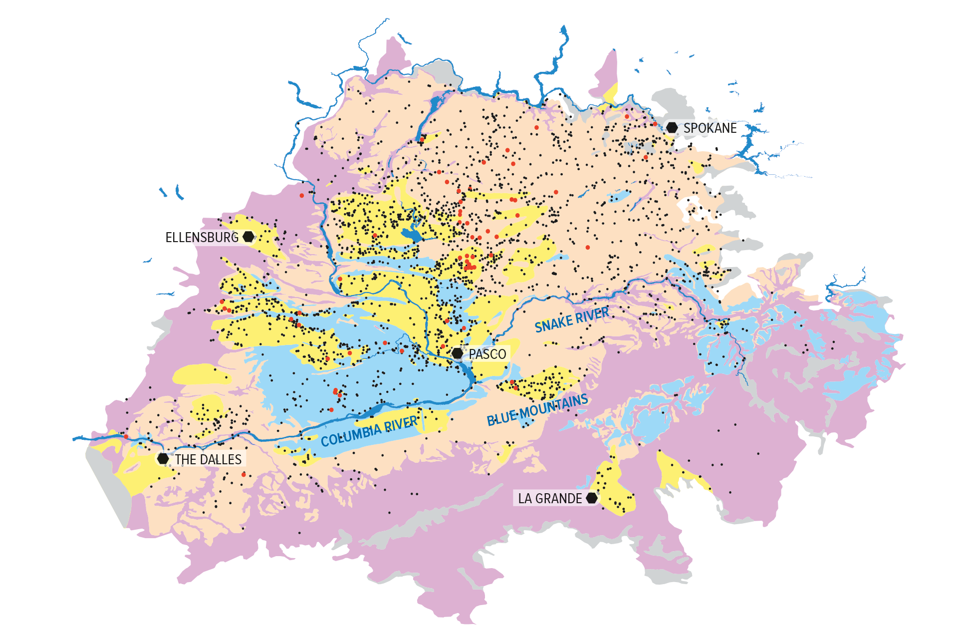
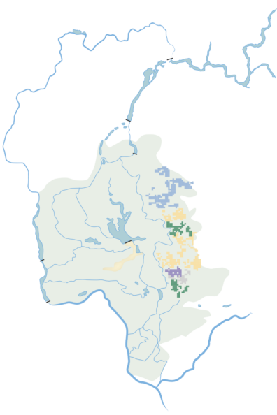
The Columbia Plateau Regional Aquifer System is a complex made up of the Overburden (yellow), Saddle Mountains (blue), Wanapum (orange), Grande Ronde (purple), and Older Bedrock (gray) hydrogeologic units—which are progressively older in geologic time and therefore found at relatively different depths (below). Black dots represent wells pulling from the aquifer system with red dots indicating wells that have had to be deepened. There are varying levels of interplay between the aquifers regarding exchange and recharge.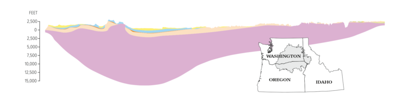 These illustrations are based on modifications to USGS maps and other digital data by Kahle et al. in 2009. Aspects and depths have been modified from actual scale so as to make unit relationships easier to distinguish.
Click here for a high resolution PDF version of the infographic.
Mapping the waters
Back in the van, McLarty and her students enthuse about the irrigation project, discuss the pleasures of seeing how their scientific work takes hold in eastern Washington fields, and discuss the finer points of well monitoring.
Such monitoring is crucial to her work. In her most recent research publication, McLarty built a picture of the Columbia Plateau Regional Aquifer System using data from more than 400 wells. And now, as more landowners stop pumping from underground and turn to surface water, well monitoring will be important for tracking progress.
To that end, they offer well monitors to farmers around Othello. Each well is another important data point in the portrait McLarty is painting of the region’s groundwater.
“My vision is to develop a regional network of point observations to observe our groundwater system,” she says. “To basically make the region a living laboratory to support water conservation.”
Odessa Groundwater Replacement Project
Explore the Odessa Groundwater Replacement Project on an interactive map.