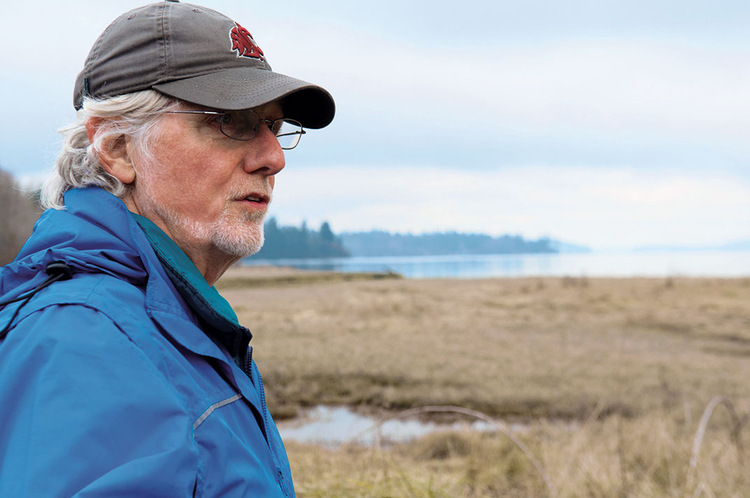
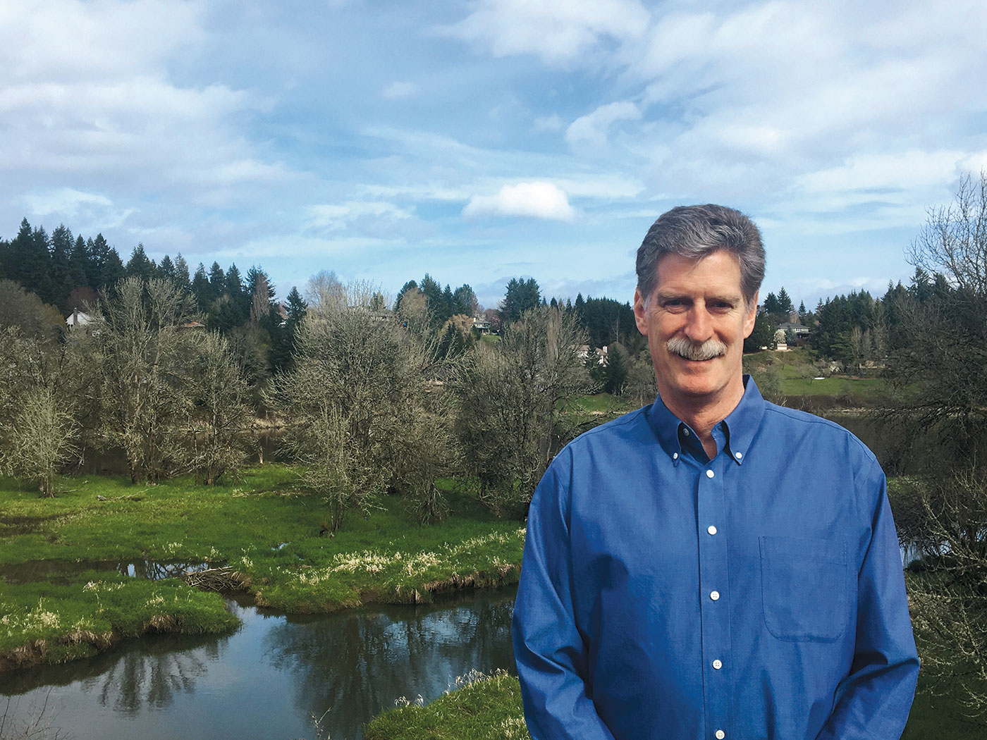
“There are oysters out there,” says Ed Bassett, “and they are good.”
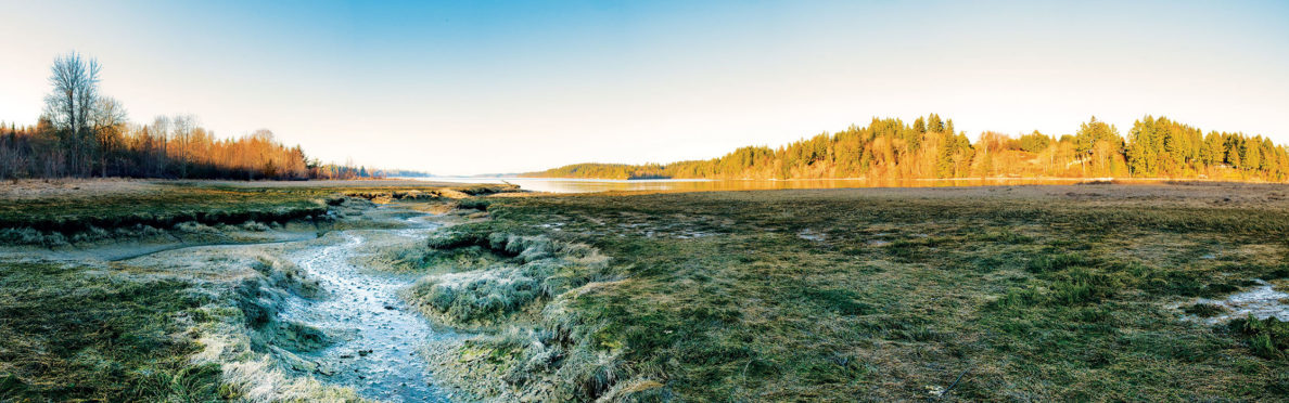
Out there are the mudflats of Henderson Inlet where a thriving community shellfish garden supplies delicacies for neighborhood parties and celebrations. Bassett (’89 Ed.) is standing in the eelgrass on the shoreline of Washington State University’s Meyer’s Point Environmental Field Station established in 2003.
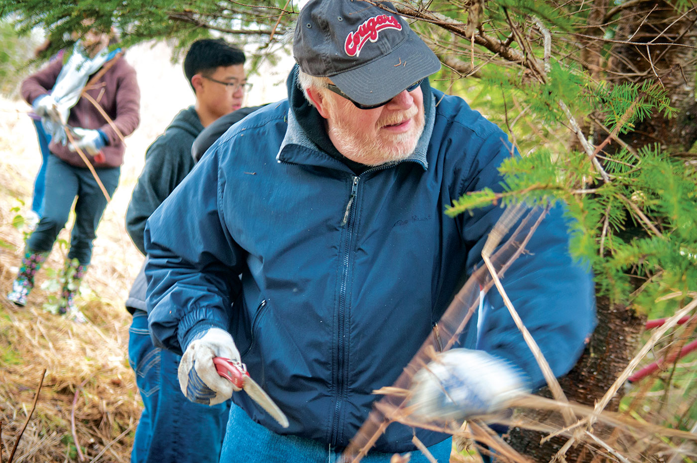
He’s a science teacher at nearby Olympia High School (OHS), and he, his students in the OHS Earth Corps, and Meyer’s Point facilities manager Chuck Cody (’84 MS Hort.) have been planting native trees here since then.
WSU environmental scientist Steve Bollens is the director of the station. He calls Meyer’s Point a hidden gem and a too-well-kept secret. Bollens and his colleagues are determined to use the site to explore the urban-rural interface, that delicate balance between the resource-intensive and environmentally taxing human infrastructure of the built environment, and our growing awareness that things just aren’t right without a healthy environment in which to play, meditate, and raise kids.
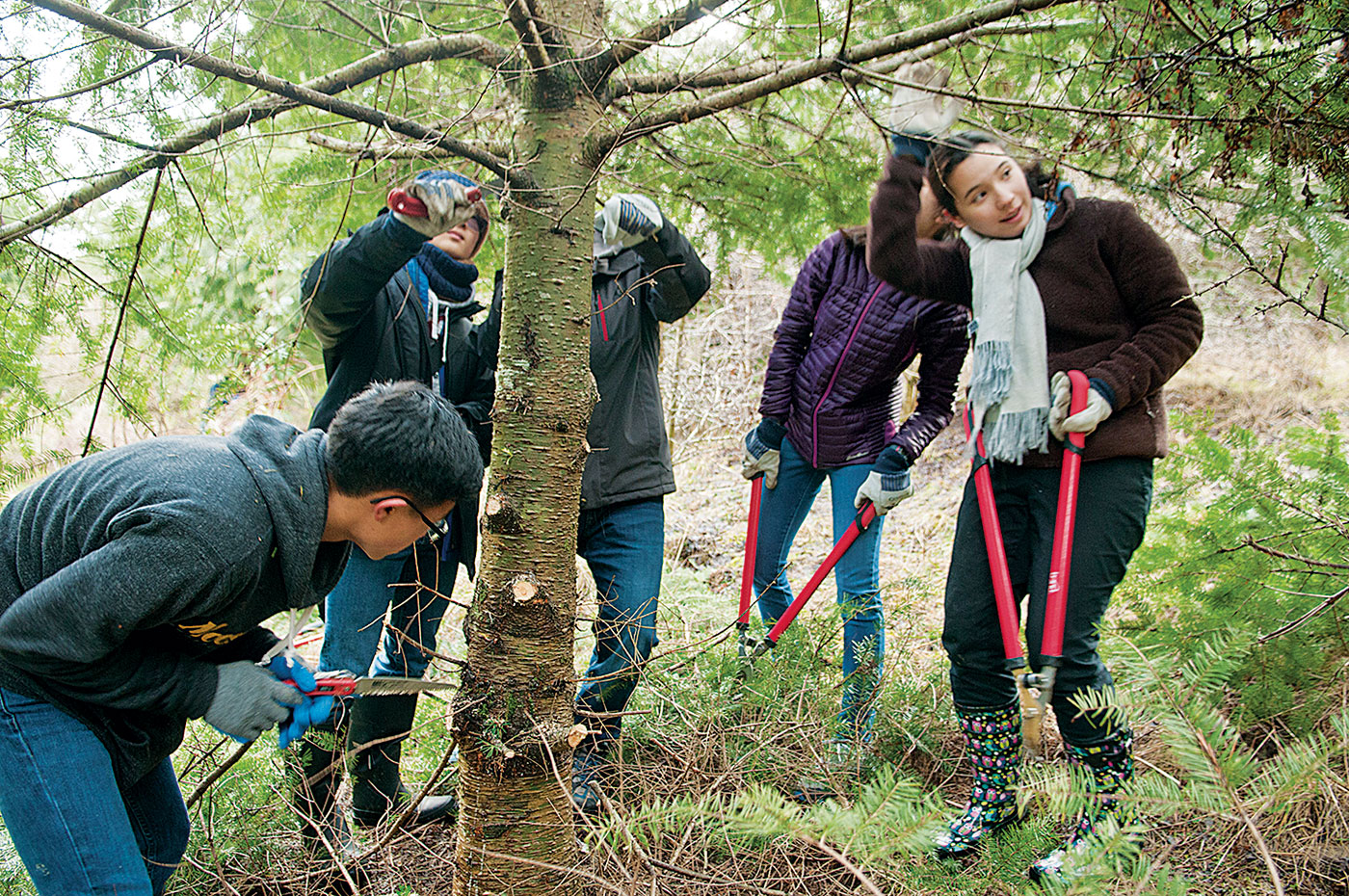
L-R: Gabriel Ong, Michael Tsien, Annette Lu, Veronika Kettel (Photo Zach Mazur)
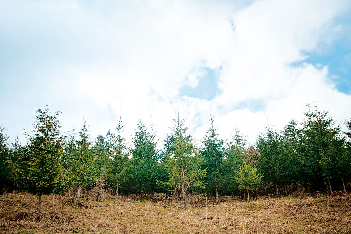
The 95-acre site has nearly half a mile of shoreline, acres of marshy wetland, and an expanding forest that climbs a steep slope. At the top of the property is a 12-acre hay field. For WSU researchers, the mix of agricultural land with forest and shoreline tantalizes mathematicians modeling forests, biogeochemists seeking to understand how fungi partner with plant communities, and archeologists who inform the present with lessons from ancient Native residents.
“There’s something for everybody,” says Bollens.
Bassett meanders through the restored forest; he offers a warning about the mud in his soft Georgia drawl: “You could find yourself in a seated position real fast.”
Bassett has been best friends with Cody since the 1980s. “We hit it off the day I was unloading my U-Haul,” says Bassett, “and Chuck stopped to help.” Cody was a graduate student in Pullman, while Bassett had come to take a job with James Cook, a wheat root disease researcher. As soon as Bassett graduated with his teaching credential, he landed the job at OHS and has been there ever since. Sometime in 2003, he got a call from Cody.
“He said, ‘I’m going to be in your neck of the woods. We have this property, and it needs a bit of work.’”
That, it turns out, was an understatement. What is now a 16-acre forest was then an abandoned dairy cow pasture that had been overrun by a vast tangle of blackberry vines. Where there weren’t blackberries, there were red alders. Cody wanted to accelerate the process of succession, with the goal of restoring a mixed-species native climax forest. Successive waves of Bassett’s Earth Corps students gave the old pasture many Saturdays over many years, tearing out berry brambles and replacing the alders with Douglas firs, grand firs, western red cedars, big leaf maple, Oregon ash, and, later, hemlocks that thrive in the protection of an established conifer forest.
The first planting, Cody says, was on Valentine’s Day, 2004. Those saplings are now 30-foot-tall trees and one of Bassett’s former students has her own virology lab at Brandeis University.
That’s not the only success along Henderson Inlet. When Cody and Bassett first started coming to Meyer’s Point, there was no shellfish garden; the water quality was too poor. But a concerted—and expensive—collaboration between local residents and various state and local government agencies and nonprofits led to an upgraded infrastructure, including better septic and stormwater runoff management systems. By 2017, and “after more than 20 years of work,” according to a Washington Department of Ecology assessment, “the results of the Henderson Inlet watershed partnership are among the most positive results in any Washington watershed.”
That dramatic improvement in water quality has meant that shellfish gardening could move to the southern end of the inlet, including at Meyer’s Point. There, OHS students volunteer to help plant oysters in the local community garden. The Nisqually Tribe, too, garden and harvest the delicacies, which they sell to area
restaurants.
Music of the mists
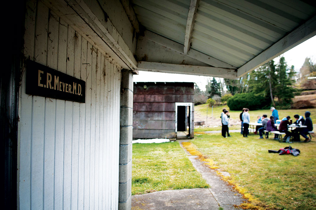
Meyer’s Point was a gift from Dr. Edward Meyer (’38 Pharm.). After medical school in Louisville, Kentucky, and service in the Second World War, Meyer returned to the area where he was raised to practice medicine. Doc Meyer’s shingle still hangs from one of the buildings at the station. Meyer bequeathed the property to WSU before he died in 1993, asking that it be used for environmental and arts research and education.
He also left the University an endowment that established professorships in the arts and sciences. Composer and saxophonist Greg Yasinitsky is a former Meyer Distinguished Professor, and he was also one of the first faculty members to visit the field station.
Yasinitsky visited Meyer’s Point in the summer of 1995. He tromped around the property for a couple of days, shooting video and making audio recordings of wind, birds calling, shoes in mud, and the lapping of water. When he got back to Pullman that fall, he composed “Meyer’s Point” for flute and piano. The one-movement piece is a challenging showcase for Ann Marie Yasinitsky, a virtuoso flutist, and perfectly evokes the ethereal mists that hover over the salt marshes and the tumbling sky that deepens the perspective up the long northward reach of the inlet.
Years later, the music still reflects the ecology of the site. As Bassett leads an expedition up into the woods, the soaring flute cadenzas seem to echo the sky-reaching trees, and the dramatic piano intervals capture the contrast of forest and marsh, of field and the murmur of streams running down slope.
On another day, Bassett might hear another sort of music: the whine of Nick Strigul’s drone as it curls above the forest snapping high-resolution photographs.
A silicon forest
Strigul is a mathematician based at WSU Vancouver, 90 minutes south of the Meyer’s Point station. “A big part of my work,” he says, “is forest modeling, the self-organization of forest ecosystems.” That’s why his drone is circling the forest at Meyer’s Point, collecting data that both informs and confirms his modeling efforts.
The trick, he explains, is to gather together all the individual studies of ecosystem components into “a single, highly complex model.” A forest is not just trees: it is microbes in roots and branches, insects, birds, animals, forest-floor flora, all of which “operate on different time and space scales and yet interact in profound and important ways. The importance of bringing mathematics to bear is that it provides a path toward understanding the interactions and differing scales.”
Getting all that data onto the same virtual page is just the first challenge. Any model, whether of climate or forest or shoreline, must be validated against reality.
“But to compare to reality, you need a data-intensive baseline to test against,” Strigul says. “It’s hard to find a particular place where you have sufficient data, where everything is measured. Where each individual tree, and all the fluxes of carbon, nitrogen, and trace gases, the soil nitrogen and carbon, where all that is known and measured.”
Creating such a baseline is expensive and long term, he says. Harvard University has an experimental forest that has been monitored for decades. But there’s not really anything like that in the Pacific Northwest. Perhaps, he muses, Meyer’s Point could become a baseline for regional forest modeling.
Since the 1960s, he explains, researchers have been using computers to model forests. Foresters want to understand how to get maximum yields and wood quality, while ecologists wanted to grasp the entire system. Foresters aren’t interested in tree mortality, because they’ll harvest before a tree reaches the end of its natural life. And the same with pests: foresters try to wipe out the pest. But ecologists want the big picture. For decades, ecologists got the short end of the computing stick simply because processors simply couldn’t handle the massive data required to model a real-world ecosystem.
Ecologists, Strigul says, “had to be very picky about what they put in their models. But now, computers are so powerful you can put all of it in there.”
The value of a high-resolution model would be extraordinary. All manner of experiments could be run in silico, yielding quality results at the speed of microprocessors instead of consuming decades of real life. The effects of a warming climate, drought, fire, and much more could be modeled, informing decision makers and resource managers about particular courses of action.
Strigul says his goal is to “drive out the uncertainty” that exists in “models that do not completely reflect reality.”
As below, so above
Harvesting and then harnessing data is the way to drive out uncertainty. Two WSU Tri-Cities scientists also see the Meyer’s Point station as a prime candidate for collecting a wealth of information about the interactions of soils, microbes, plants, and their effects on ecosystem health.
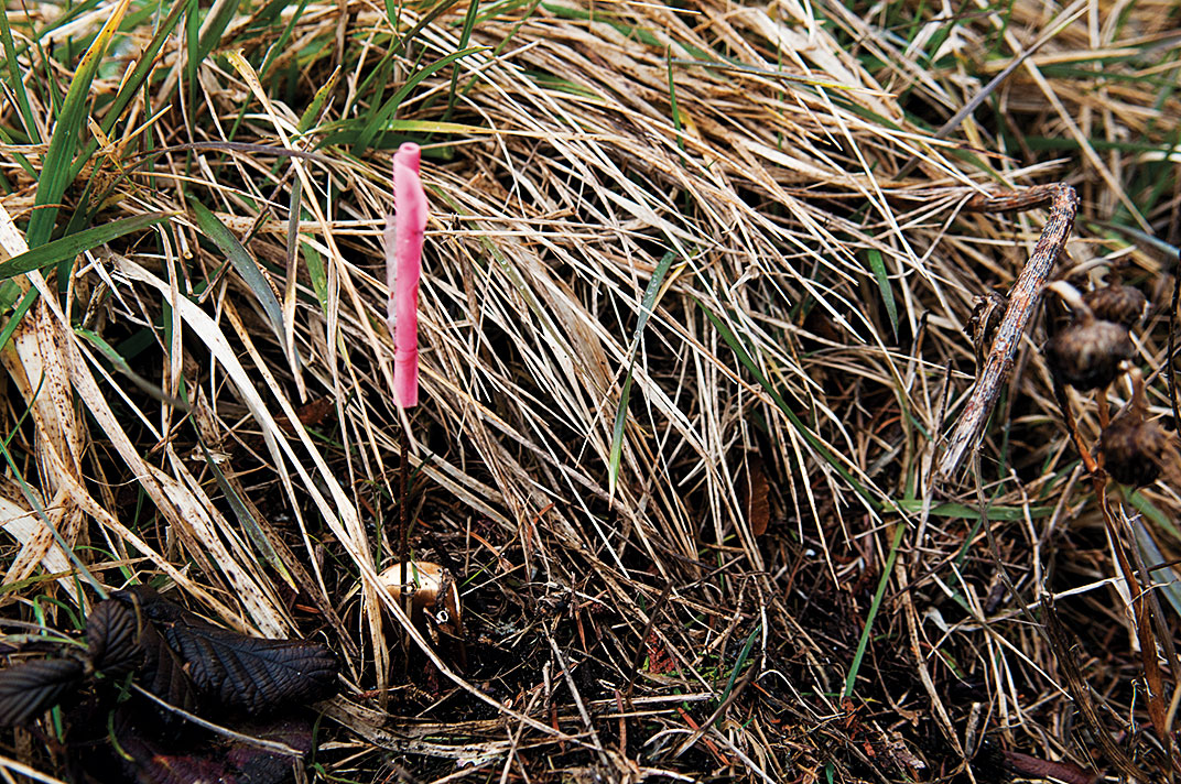
Biologist Tanya Cheeke and her colleague, environmental scientist Sarah Roley, along with some of their students, have teamed up to collect and analyze soil samples from the up-slope hay field at Meyer’s Point. The goal is to identify the particular mycorrhizal fungi that associate with plant roots and “create an intimate two-way exchange of nutrients,” as undergraduate Ella Krinitsyn wrote in a recent presentation.
Understanding the symbiotic relationship between plant species and their fungal partners is critical to restoring native plant habitats. Those associations develop over time, but when soil is disturbed, as for a building project, that relationship can become threatened, to the detriment of native plants. That’s one of the reasons weeds encroach on highway margins and building sites.
In the past, Thurston County managers have put major emphasis on maintaining and, where possible, improving environmental quality in the south Puget Sound region. Statements from the County Planning Commission indicate that sustaining a healthy economy and environment will be maintained in the future, aided in no small part by efforts to model forests and understand the role of fungi in soil and plant health.
Walking along the hay field and along the dense forest at the top of Meyer’s Point, station director Bollens says that having an environmental field station “sited at the rural-urban interface is uncommon. There are a few truly urban field stations, but they’re rare. There are many more that are as far away from humans as possible in order to maintain pristine habitats.”
The north Sound is already densely populated and developed. “The south Sound is going that way, but is figuring it out. How do you provide opportunity for economic growth while maintaining ecosystems in a sustainable way?” That’s a twenty-first-century challenge, he says, one WSU is perfectly situated to address.
A backwards glance into the future
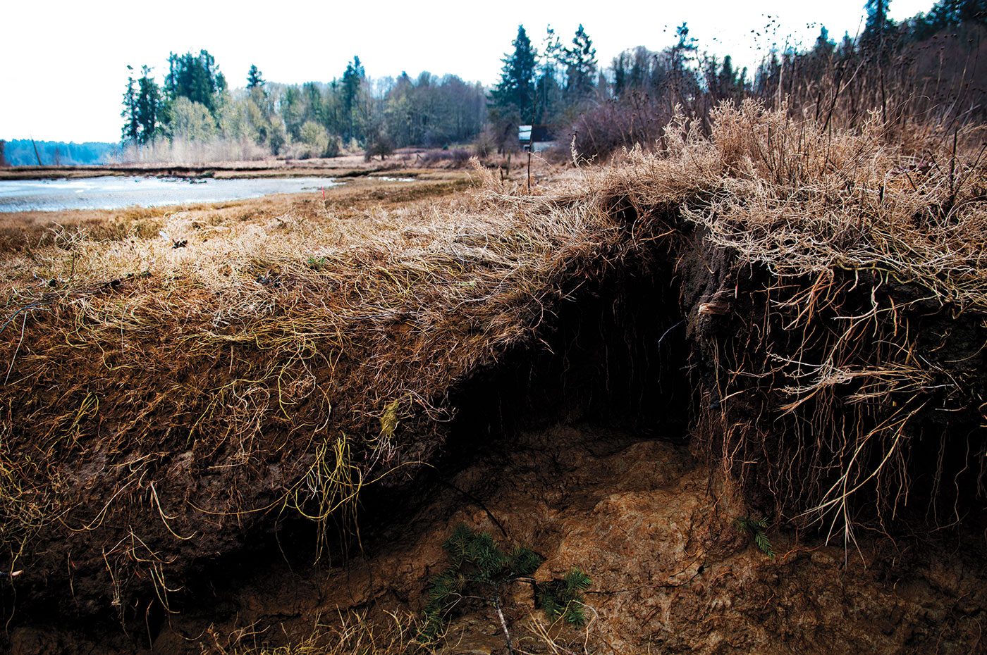
WSU archeologist Colin Grier thinks a lot about twenty-first-century challenges and argues that what we face now and in the near future is nothing entirely new. Walking along the shoreline, he points out an archeological site that is at least 500 years old. It’s a band of shells embedded in silt just a few meters above the high-tide line.
“That shell midden is a record of dinner by dinner decisions over 500 years. It’s a fine-grained view of adaptation strategies.” What native peoples selected to harvest and what to leave for growth might be guides for shellfish gardeners today.
The Coast Salish peoples, Grier says, “had a system of proprietorship, rather than ownership, so it was a system of responsibility rather than exploitation. You own it in some sense, but you have a responsibility to manage it for the greater good.”
There’s an ancient campsite just up shore from the shell midden. A bowl-shaped hearth of fire-altered silt and rock has a bone sticking out of it. People have been camping along these inlets for thousands of years, Grier says, as they moved up and down the coasts between major settlements.
“It’s no coincidence that a lot of modern settlement is right on top of indigenous settlement. The places that are amenable to the way we live our lives, 15,000 years ago as well as today, involve a lot of the same decisions. People want access to transportation, to food and resources, to neighbors.
“So this is sort of a microcosm of all the sustainability issues on Puget Sound,” Grier continues. “Looking back to see what the baselines are, looking forward to what they should be, and trying to preserve the record that has all that information: that’s why I think shorelines are so interesting. They’re the nexus of all these dynamic issues and processes, past and present, coming together.”
As he picks his way across the mud and dices around pools of salt water, Grier’s boots squish and squeak. It’s the music of Meyer’s Point, a metronome that sometimes skips beats but that always comes back around, a rhythmic cycle of interconnection that Grier sees in both the contemporary philosopher of science, Bruno Latour, and “the indigenous view of the world, that everything is connected and that there are all these complex relationships that are beyond human control.”
As he looks north, up Henderson Inlet towards Dionisio Point on Georgia Strait, where he’s been excavating and collaborating with indigenous Salish Sea tribes for 20 years, Grier says, “One thing I ask my students to think about is this: what do the ancient Greeks, the Romans, the Mesopotamians, the Maya, the Inca, what do all these cultures have in common? They are gone! What they left behind is as close to a laboratory as archeologists are going to get, and it’s a window on the interaction of ecology, politics, economics, technology.” Those interactions are precisely those we, too, must contend with in the present.
Shoring up
Puget Sound is the third largest estuary system in the United States, after the bays of Chesapeake and San Francisco. It’s a young environment, with gravelly soils ground up and laid down by glaciers. Fifteen thousand years ago, the Vashon Glacier buried this region under thousands of feet of ice. The massive glacier shoved south of Olympia at its greatest extent. As the planet entered the warming Holocene, the glacier retreated, melting, filling the finger-like fjords of the Sound with water. Plants and animals rushed back in to the newly hospitable environment; biology abhors a vacuum.
Now, as the climate is changing again, Bollens and others consider how this jewel-like spot of earth might help us meet our future with grace. One of the values of Meyer’s Point is that it inspires awe and a love of nature. And that inspiration is a timely remedy to the angst and fear that permeates discussions about climate change. And while that fear is in some sense justifiable—if we’re not to burden today’s children with a grim, superstorm-ridden future, time is indeed short to make meaningful change—fear also paralyzes while love of nature energizes and motivates constructive action.
Someday, Bollens speculates, a trail system might connect the field station to other ecological reserves on Henderson Inlet. But, he cautions, public access has to be balanced with maintaining the integrity of ecological and archeological research sites. Bringing together the missions of research and public education in a place this fragile, Bollens says, “is a balancing act.”
“Virtually every field station has this tension between maintaining resources for researchers and wanting to open things up for the public,” he explains. “Some are so remote it’s a moot point.” Not Meyer’s Point, here in the midst of millions of people.
Is that balancing act daunting? Standing next to his car at the entrance gate, Bollens looks back down the slope to the shoreline and says, “It’s daunting in that it takes millions of dollars to build facilities and infrastructure. But this is a fabulous site and is already drawing support.”
Bassett is leaving, too. All the volunteer hours students have given this place, he says, have also taught them the principles of ecological succession, how species change over time. That time frame might be millennia, as after a glacial recession, or it might happen in the decades after a volcano or fire has devastated a landscape.
But most of all, he says, is they just wanted to clean the place up and have it full of native plants and wildlife. Overhead, birds on the Pacific flyway call and then, as the sound of departing cars fades away, everything is quiet except for the music of the wind in the trees.
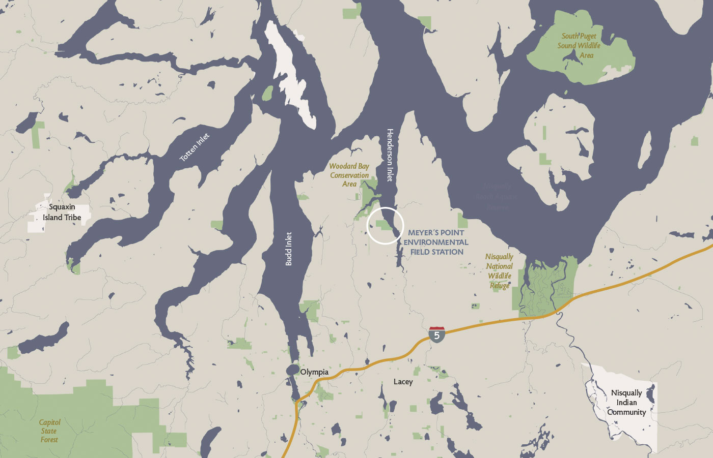
Click on image for larger PDF map