The Palouse, in its way, is a perfect place. A land of soft, rolling hills framed by rivers, mountains, forests, and desert, this agricultural hinterland feels all four seasons fully, and in all likelihood grows enough food to feed its inhabitants and visitors with ease. It’s home to scholars and farmers, and its story begins in the ice ages and continues today with an unrelenting flow of research from two major universities.
Despite such beauty and bounty, the Palouse has not received the artistic consideration that has Yosemite or Hudson Valley. I’ve never seen anything like that, at least until a day last winter when I stumbled into the Owen Science and Engineering Library to escape the cold.
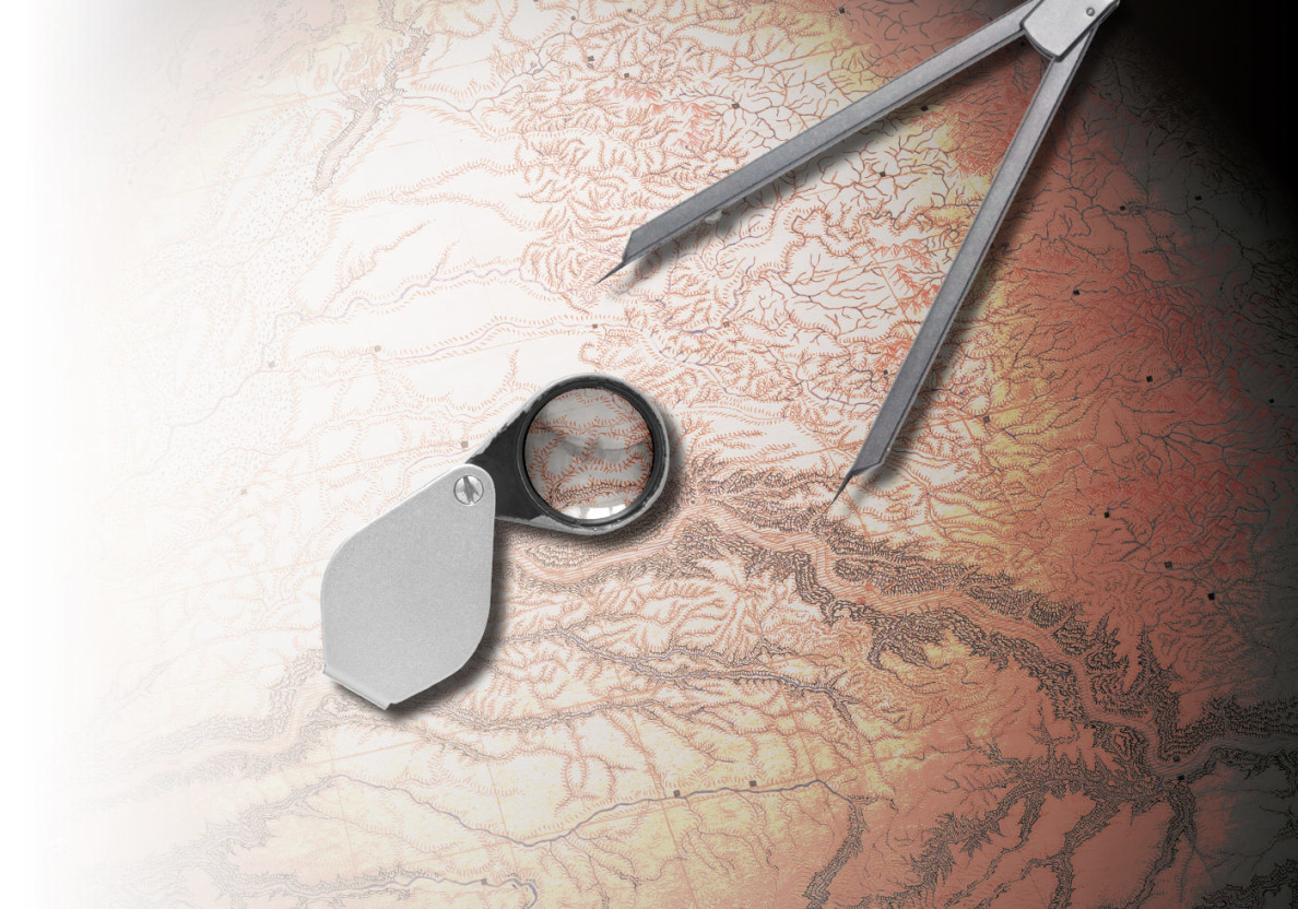
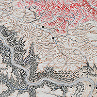
There, pinned behind glass in the lobby, a large, color ink-drawn poster of the Palouse grabbed my attention. It was stunning, with countless details of the landscape stretching north of Oregon’s Blue Mountains and the Walla Walla River, and to the south of Lake Coeur d’Alene and Ritzville. Near the center, two dots represented Pullman and Moscow. It lay in perspective, projecting from the southern end, making the north look smaller and farther away. I inspected the map for probably 20 minutes before I looked at the tag accompanying it. Artist unknown, date unknown.
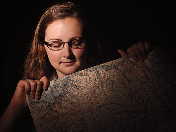
I was intrigued, naturally. Who would spend the countless hours creating such a stunning piece without affixing their signature? I met with Chelsea Leachman, the reference librarian who displayed the map, to get some answers.
She led me to a locked, well-lighted room on the third floor of Owen that contained a pile of more than 400 hand-drawn maps very similar to the one displayed in the lobby. The maps detailed the natural features of Washington state with intricate color pencil drawings. Purple volcanoes shot puffs of smoke into the air, and blue rivers tore through mountain ranges. The features appeared in greens, browns, yellows, pinks, blues, and purples—a veritable cartographic rainbow.
The backs of the maps identified what was on the front, and overflowed with shorthand notes on geology and history, footnotes to published works, and names of prominent geologists. Some of the maps contained catalogues of mountain peak elevations, and some were careful reproductions in triplicate. Much of the writing, while clear in style, was close to indecipherable in content. Conjugated words with superscript letters baffled me. Dense paragraphs filling the entire page daunted me. These maps, it appeared, were the culmination of years of effort, easily. This was the work of a very dedicated mapmaker—or perhaps a group of them.
“When I saw the big map, I knew I had to display it,” says Leachman. “But nobody knows who drew it.”
That includes three emeritus professors from the geology department, now the School of the Environment.
“The whole map collection was donated to the library [by the geology department] several years ago. Part of it was from the standpoint that these things are old and needed to be preserved. We didn’t have a good place for them,” says geologist Gary Webster. The maps were already around when he started at WSU in 1968, but he doesn’t know who drew them. “The maps may be approaching a hundred years old, but that’s awild guess.”
Experts at the University library’s Manuscripts, Archives, and Special Collections had never heard of the maps, but were immediately intrigued, like me. Everyone who saw the maps was stunned by their precision and beauty. And no one had a clue who created them.
There are no dates written on any of the maps to identify date of completion, no signature to claim creatorship. As the mystery deepened, so did my resolve to find the unknown cartographers. I was on the trail of a mapmaker, but the trail was cold.
So I began with Leachman. She had done some digging herself and found the name “Frank McCann” on the back of one of the maps.
“He was a resident of Coulee City and amateur geologist,” she wrote in an email. “What I have not figured out is how they would have ended up at WSU.”
McCann was a longtime resident and business leader of Coulee City who was called “The Daddy of Grand Coulee” for his efforts to educate the world about his adopted region.
When McCann first arrived in Coulee, it “was only a scar on the face of the Earth,” according to C.T. Giezentanner in The Chalice of the Gods, an out-of-print book about the Coulee area. “Dry Falls was called a ‘Damned Pot-hole’ by the stock men who roamed the range.”
But with McCann’s unremitting boosterism, things began to change. He wrote a series of articles describing Grand Coulee as “the outstanding geological feature of the state of Washington.” He convinced prominent geologists like J Harlan Bretz, the famed scabland elucidator, to visit Coulee and escorted them on their explorations.
Eventually, and by no small effort of McCann’s, a dam was erected, one that is still the country’s largest power-producing facility. “What nature intended, but never completed,” is how McCann described the dam. Unfortunately, three years before the dam was completed, McCann “dropped dead when he stepped from his car at a service station while en route to his boyhood home at Northloop, Neb.,” according to his obituary in the Spokane Daily Chronicle. The 1939 article was sure to mention McCann’s “national reputation as an amateur geologist.”
But there was no mention of mapmaking in any article, let alone any connection to Pullman or the University. And the name Leachman had found appeared on the back of a map of the Coulee area. Was it simply a reference to his work?
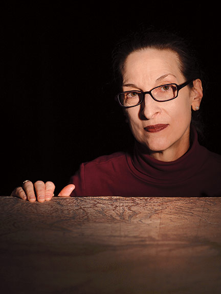
In need of answers, I did what any wayfaring writer would and went to an expert. Cheryl Gunselman is the manuscripts librarian with MASC, and her office windows look over a reading room where pens are prohibited and white gloves are required. Talk to Gunselman about history and she is easily, and uncommonly, excited.
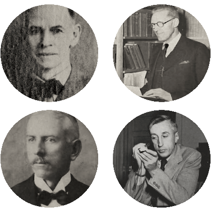
Soon after hearing about the maps, she mentioned Solon Shedd, the first university-trained geologist to teach in Pullman, as a potential maker. Shedd came from Stanford in the fall of 1896 to teach six courses in geology and mineralogy. Until this time, a man by the name of Elton Fulmer had taught geology—but he was a trained chemist who also taught chemistry, pharmacy, and assaying. This was no big feat when the entire student body numbered just 57. But as the students came in greater numbers and Fulmer was appointed state chemist, he hired Shedd.
In 1905, the Washington State Agricultural College Experiment Station and School of Science became Washington State College, and Shedd was made professor and obtained his master’s and doctoral degrees from the new college. He also was named assistant state geologist, which is why Gunselman mentioned him to me. In this capacity, he created survey maps of the state. Maybe the maps in Owen were his field notes, Gunselman suggested.
The notes and drawings seemed too carefully rendered to be field notes to me, but her theory was better than mine, primarily because I had none. I looked at the maps closer and began to see names and dates. Daly 1903. Weaver 1916. Stanton 1898. Landes 1901. I plugged these into the library’s database and realized these were references to published papers on regional geology. Shedd’s cartographic authorship grew in my imagination.
Then I saw Barksdale 1947. And C.C. Popoff 1948. My heart sank. Shedd had died in 1941. He was out. So was McCann for that matter.
Still, Shedd’s role as state geologist grabbed me as rife with potential. Perhaps his successor drew the maps?
Harold Culver looms large over the study of geology at WSU. After teaching for six years at the University of Washington, Culver worked as chief of the coal division for the Illinois Geological Survey, during which time he obtained his doctorate in geology from the University of Chicago. So when he came to Pullman in 1925 and replaced Shedd as both head of the college’s geology department and supervisor of the state Division of Geology, he had both the academic and administrative experience needed for the roles.
Right away he began work on the first official published map of the state of Washington, which would replace the “sketch map” done in 1901. He enrolled other instructors and advanced students to assist him, an effort that would take decades. According to an obituary of Culver by the Geological Society of America, Culver’s mapping work was impressive, as “large unmapped areas were filled in well enough to be useful to the U.S. Geological Survey for inclusion in the 1932 map of the United States.” Four years later, in 1936, Culver published the official geologic map, accompanied by a small book, The Geology of Washington. It’s a dry book—as official books on geology can be—but the names in it matched those on the maps. Daly. Weaver. Pardee. Bretz. There was a problem, though. The map was published eight years before the latest reference I found on the maps: Popoff 1948, which as far as I could tell referred to investigations done on the limestone and silica deposits in Skagit and Snohomish counties.
Still, I reasoned that while Culver’s map was drawn years before the final dated references, he could have continued his map work after publication. Culver didn’t die until 1970, long after the final date on the maps.
Gunselman, the archivist, recommended I consult old course catalogues to see who was in the geology department, and when. I thought it might help me chase my Culver idea down. In fact, it did the opposite.
When I pried open those dusty old books, I was hopeful. In 1936, Culver taught field geography, which involved “detailed mapping of the area.” He taught it again the next year. And the year after that. In 1939, the class was taught by the generalized “staff.” But in 1941, a new class entered the catalogue called “Preparation of Geologic Illustrations.” It was taught by Ralph Lupher, who ran it for five continuous years.
Lupher came to Pullman in 1931 as professor of stratigraphy and paleontology. Immediately, he took an interest in local geology and spent much time in the field, contributing to Culver’s work on the state map. Outgoing and amiable, Lupher became popular among students, not just for taking them on his impromptu weekend field endeavors, but also for the open door at his log cabin home on A Street, which was later razed and turned into a fraternity parking lot.
Before the student body boom of G.I. Bill soldiers, the geology department had dwindling numbers of students and Lupher left Pullman in 1945 for work with Shell Oil Company assessing the oil and gas potential in southwestern Washington. His work with Shell was solitary for seven years, when he “traversed all available roads, jeep trails, and old railroad grades, collecting samples and recording geologic information.” He created such a comprehensive report that Shell still referred to it 30 years later, according to a memorial written after his 1979 death.
Again, I thought I might have found my mapmaker, but nowhere was a mention that Culver or Lupher left behind a trove of maps. I thought if I found a sample of handwriting to compare with the tens of thousands of letters on the backsides of the maps I could maybe find my cartographer. Again, I headed for the archives.
When I left the sunshine for the ground floor reading room in Terrell Library, Gunselman sat me down with a pile of personnel files and other ephemera.
Culver, kindly enough, left the University his field notebooks, a collection of leather bound journals filled with decades of his observations. I opened the first, my mental fingers crossed. Instead of the neat, blocky letters of the map, I found instead the clean lines of cursive, page after page, year after year, decade after decade. The man had great penmanship, I had to admit, but he was not my cartographer.
I moved on to Lupher, whose personnel file contained exactly one piece of paper. It had no handwriting.
At this point, my intrigue turned to frustration. I was looking for a geologist, someone who made a vocation out of studying change over a vast period of time, someone whose subject of study is so long lasting it appears as permanent to us, especially when viewed over the course of one human life. Geological features, generally, are static. The permanence of the natural world lasts the course of many generations. Sometimes they outlive an entire species. They say mountains crumble to the sea, but Mount Rainier is 500,000 years old. For that matter, the Pacific Northwest has been around tens of millions of years.
But I was frustrated because I realized how impermanent my mapmaker allowed himself to be, simply by not signing anything. Here was someone who lived in the last century—not even worth a mention in the geologic sense. Yet he left no mark of himself.
I was beginning to think that geologists sacrificed their own human stories for those of the world beneath and around us. So I went to the source of all stories: People.
The geology department was disbanded more than a decade ago and reconstituted as a program in the School of the Environment in 2012. Today, there are three emeritus professors who taught in the defunct geology department: Gary Webster, Philip Rosenberg, and Franklin “Nick” Foit. Of anyone on campus, I thought, one of these men must know who drew these maps.
“I have no idea where they’re from,” says Rosenberg, who came to Pullman in 1962. “I think they probably have been around for ages.”
Foit came to WSU in 1971, and had never seen the maps but, like me, thought they were very cool.
Webster, who knew of the maps but not their maker, said there was one person who definitely knew who made the maps.
“I’ve racked my brain. I came here in 1968. I have the feeling that the fella that might’ve known is long dead. Chuck Campbell,” Webster says. “Chuck Campbell was the history guy here. A wealth of information. I’d always go to him.”
Campbell taught geology in Pullman from 1934 to 1971, and his personnel file in the archives was the fullest of any I dug through. His records state he double majored in geology and French at the University of Michigan, but he could also read German, Spanish, Russian, and Italian. His employment in Pullman began with a Western Union telegram dated July 12, 1934. It was from E.O. Holland, the college’s president, offering him the position.
He took it, of course, and like many of his fellow geologists he spent summers doing “geological mapping … chiefly Ferry County.” You might think I grew excited at another potential rabbit hole. I was not. I quickly realized Campbell was not my mapper simply because of his handwriting, which was loose, a bit sloppy, and looked nothing like what I saw on the maps. But it didn’t matter. Campbell liked to write, and I thought that among his documents I could find a clue. He was head of the department from 1950 to 1961, after all.
More importantly, he wrote “An Informal History of the Department of Geology,” a 30-page account overflowing with information about the department’s first 80 years. Everything from how long each professor taught in Pullman to each building in which geologists toiled made their way into Campbell’s account, though he admits that “much of the iceberg is … tantalizingly out of sight.” For instance, to illustrate his point that not all details could be included in such a history, he gave us but one: “One secretary … who was an Arthur Murray dance instructor, (was) drenched in perfume that has only recently disappeared from Morrill Hall, but which helped to counteract the smell of scorched wood around the assay furnaces where Phil Rosenberg’s lab now is.”
Campbell does furnish his history with interesting facts that bump against geology. For instance, the foundation and trim for the Administration Building, now called Thompson Hall, was made from granite pulled from Medical Lake, near Spokane. And the building brickwork “was made on the spot, from loess excavated from the slope across the road.”
Good stuff, just not what I was looking for. The illustrative details I was looking for, as he admits, are tantalizing and, sadly for me and my map quest, out of reach. “Inclusion of all these touches would effectively baffle any person wishing to find hard data in this story: they are left out, regretfully.”
I did not seek hard data. All I wanted was one mention of a geologist’s mad desire to make map after map. One sentence conveying a specific professor’s hobby of scrawling too much data on reams of colorful maps. But there was no such mention or sentence. Regretfully.
I sat down with the map one last time, poring over front and back, looking for the smallest detail, the smallest clue, and grew increasingly disheartened. When I stepped back to catch my breath and looked at the map from a distance, I was again struck by their beauty, like when I first saw them months before. And I realized, it didn’t really matter who made them. Like the mountains and rivers they illustrate, you don’t really need to know how they were built to appreciate their grandeur. Sometimes just looking at them is enough.
Web extra
 The mystery map – A large version of the map at Owen Science Library to peruse