(from Day Hiking Mount Rainier, published by The Mountaineers Books).
Shadow Lake Sunrise Camp Loop. This July-October hike was selected because it is fairly level, kid-friendly, and features a lake and lots of wildlife. This hike is usually open July through September.
Rating/Difficulty: 2
Loop: 3.5 miles
Elevation Gain/High Point: 200 feet/6,400 feet
Season: July-October
Dan writes: This is the perfect outing for families, or for anyone wanting an easy day in the glorious wildflower fields of the Sunrise area. Indeed, if you have out-of-town guests you want to impress, this gentle mountain stroll will have them thinking you live in heaven on earth. This little loop explores wonderful alpine meadows and provides glorious views of Mount Rainier, with very little elevation gain.
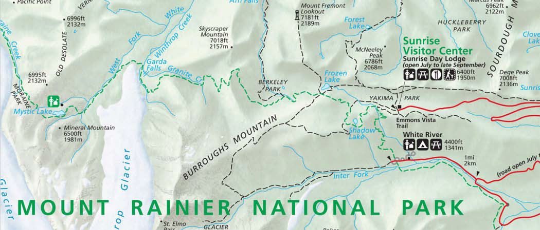
Getting There: From Enumclaw, drive east 43 miles on State Route 410 to the Mount Rainier National Park White River Entrance. Veer right onto the Sunrise Road and follow it 17 miles west to the large parking lot and visitor center at the road’s end. Note: Sunrise Road usually doesn’t open until early July.
On the Trail: Find the old road-turned-trail on the south-west side of the visitor center parking lot and follow it west toward Sunrise Camp, ignoring any faint side trails. At about 0.5 mile out, you’ll notice a well-signed trail leading to the left—this is the Wonderland Trail, dropping down to White River. Continue straight ahead toward Shadow Lake and the Sunrise Camp.
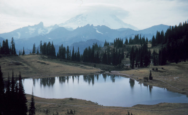
Shadow Lake, 1.2 miles from the trailhead, is a shallow tarn nestled into the green meadows of the area. With its modest scattering of trees around its banks and open slopes between the wooded sections, the lake is a haven for wildlife. The trees provide perches and shelter for birds and good shade and cover for beasts. Deer frequent this pond, as do mountain goats, so approach it quietly if you want to see any visiting critters.
After passing a short spur to an Emmons Glacier overlook, you reach Sunrise Camp at about 1.8 miles. This was once a drive-up car-camping campground, but it is now a walk-in tent camp. At the junction on the far side of camp, turn right—the left fork leads to Frozen Lake and then steeply up the side of First Burroughs Mountain (Hike 28). The right fork leads you along the wildflower meadows below Burroughs for 0.6 mile to reach yet another trail junction. Go right here and follow this main path 1.4 miles back to the trailhead.
Note: There are many old, decommissioned trails in the area. Stay on the main paths at all times.
Reprinted with permission of the author.
 Map courtesy National Park Service
Read more about Nelson in “Dan Nelson ’89–25,000 miles of trails”
View or print the Shadow Lake Sunrise Camp Loop hike as a PDF