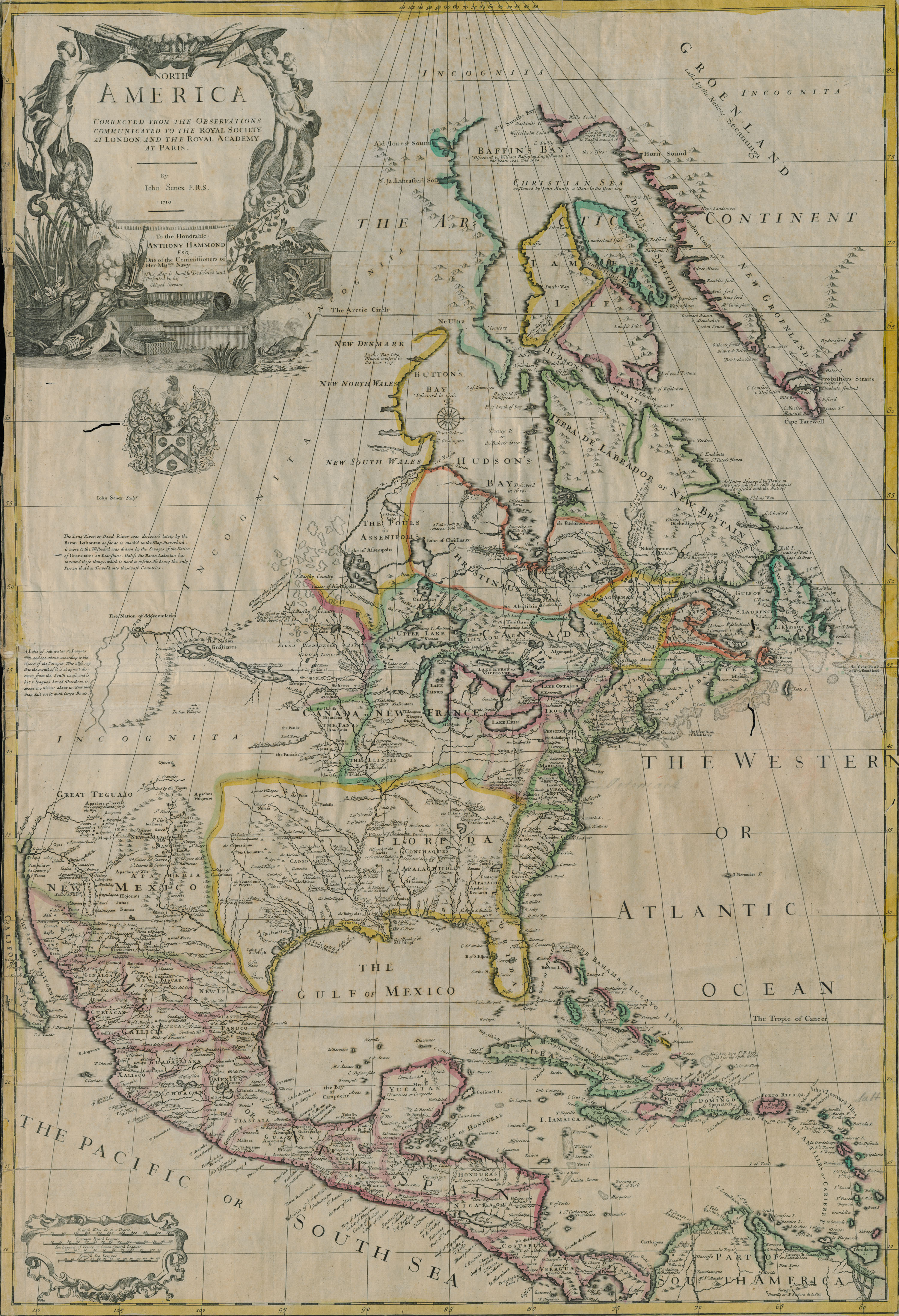
There were still plenty of blank spots on maps when cartographer and engraver John Senex (circa 1678-1740) created this 1710 map of North America. It is one of 33 early eighteenth-century maps from a Senex atlas in Manuscripts, Archives, and Special Collections, acquired by the WSU Libraries in the mid-1950s. The atlas lacks a title page, but it is almost certainly Senex’s Universal Geographer, published circa 1725. It includes the bookplate of Sir Archibald Grant of Monymoske, Baronet (1696-1778), and was formerly part of his library.
Courtesy WSU Manuscripts, Archives, and Special Collections